Drive the valley road Shorter
With the landowners' permission to drive into the valley, the walk is 1.7 km shorter each way.
West Iceland · Reykjadalur, Miðdalir, Dalabyggð · Hiked September 2026
From a birch-lined gorge to broad summit views over western Iceland
 GRAFARTINDAR 869 M TRAILHEAD
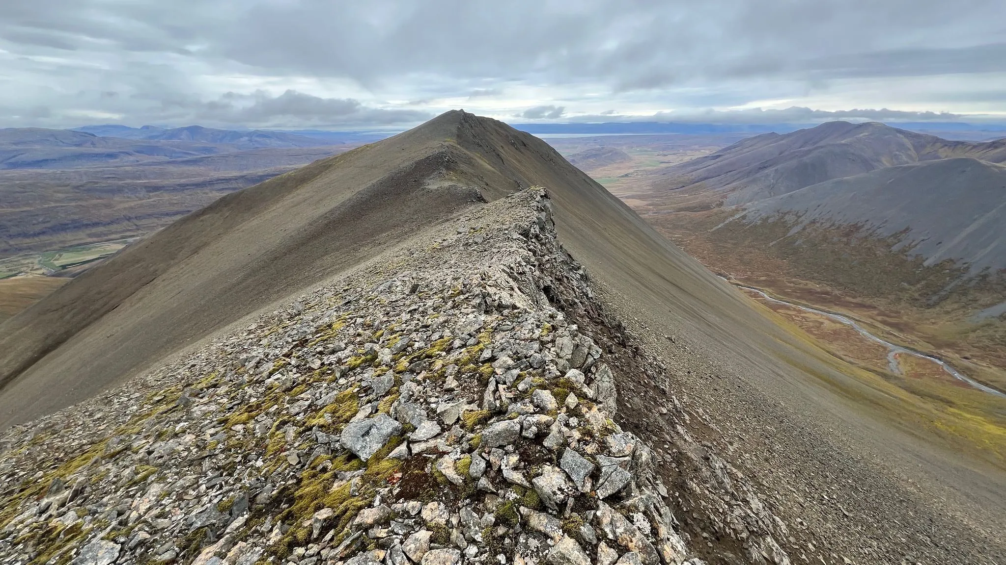
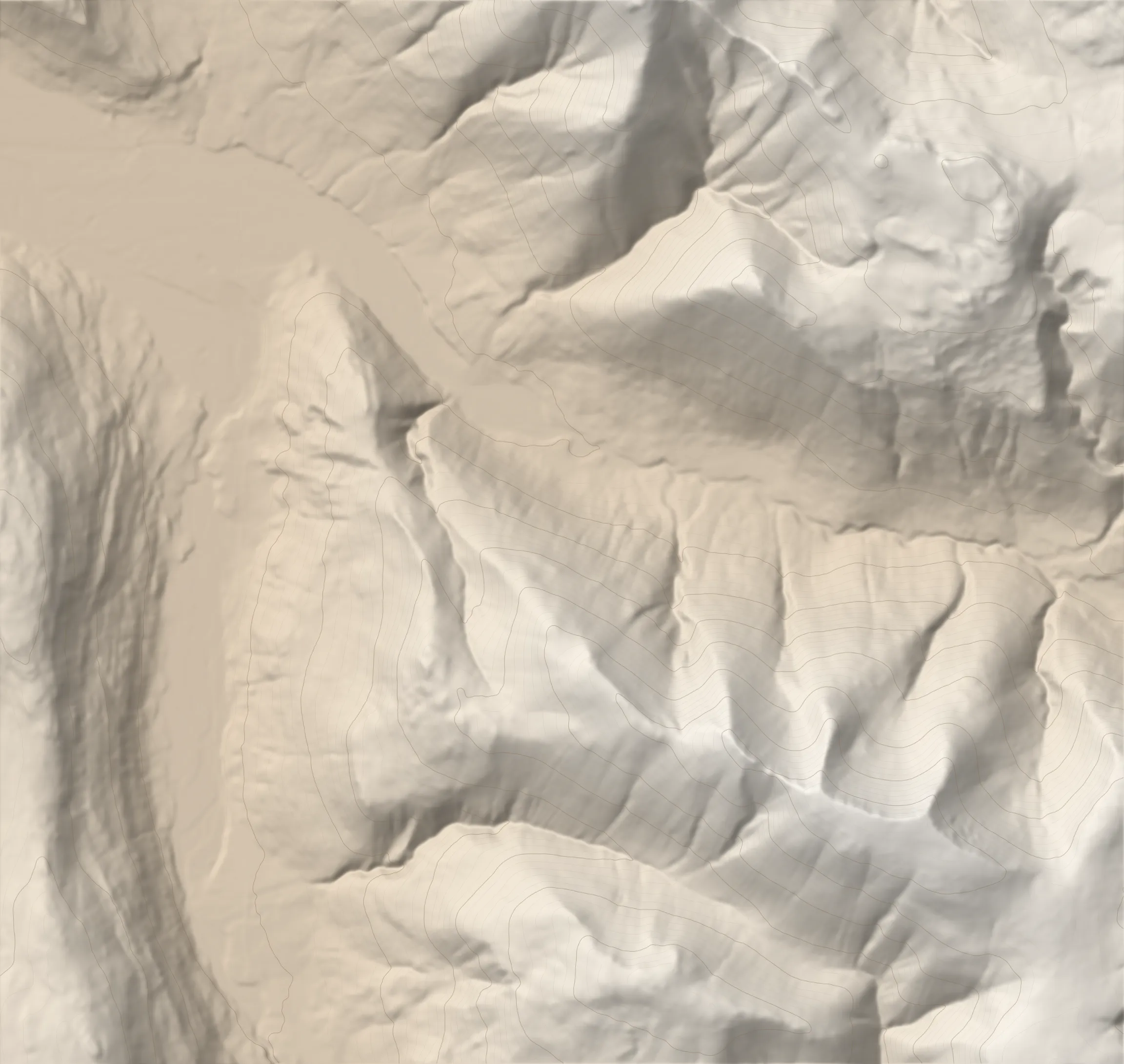
Grafartindar, "the peaks of Gröf", is a cluster of four tops above Reykjadalur in Miðdalir, named after the farm at the turn-off from Route 60. From the valley road you climb beside the Reykjagil gorge, through overgrown birch along its edge and past a waterfall, then over a couple of false summits to a broad summit plateau, and return the same way. It takes about three hours to reach the top. On a clear day the views are expansive, with Baula's cone to the south, Hvammsfjörður, the inner arm of Breiðafjörður, to the northwest, and the glaciers of Eiríksjökull and Langjökull to the east.
Start near the main road, Route 60. Follow the dirt road ENE past the sheep roundup pens, then around its bend into Reykjadalur.
0.0–1.7 km · level, heading ESE · 61 → 87 m (2%)
Terrain Dirt road up the valley floor.
Intersection · 1.7 km · 87 m
Pass a summer house, then a stream on the right. Leave the road and start the ascent up the grassy east bank of the stream. No stream crossings on this route.
Terrain Follow the faint sheep path as it leads up along the deepening canyon, with some overgrown birch to brush against.
1.7–4.0 km · steep climb, heading SSE · 87 → 689 m (26%)
As you emerge from the birch, start angling left (southwards), still following the canyon edge. 2.0 km
Hazard A bit of moderate exposure on the canyon edge as you work through the birch. It can presumably be avoided by going further into the birch thicket.
View A delightful waterfall on your right.
Terrain Underfoot it gets a little rocky, with some scree.
Terrain The slope mellows and underfoot it is mostly moss and low shrubs. 2.0 km
View In good visibility, the couple of humps that make up the ascent are right in front of you.
Terrain The moss starts to thin out as the slope steepens. 2.6 km
The slope mellows a bit. To your right, the earlier narrow canyon widens into a valley that separates this ridge from another ascending ridge, which eventually meets this one. 2.9 km
View At the bottom of that valley the stream still has a series of waterfalls.
Terrain Underfoot there are still patches of moss, but otherwise it is dirt and rocks, and not uncomfortable to climb on.
The slope steepens again. 3.2 km
Emerge from the steep slope onto a relatively flat plateau. Another false peak should be visible right in front. Keep right a little for a mellower ascent line. 3.4 km
Continue ascending gently SSE. The round top is in view ahead. 3.9 km
View To the south, the silhouette of Baula.
4.0–5.9 km · climb, heading ESE · 689 → 869 m (10%)
Continue on a flat plateau. 4.1 km
Start another climb, for the peak plateau. Aim slightly right of the rock formation you see at the top, which makes the ascent a little more direct. 4.5 km
Reach the ridgeline. The highest point should now be visible about a kilometre ahead; follow the ridgeline to it. 4.8 km
Hazard A steep drop on the other side of the ridgeline.
From a small top on the ridge, descend slightly into a dip before the final climb. 5.0 km
Terrain Some scree, both on the descent into the dip and on the traverse.
Emerge onto a plateau. Keep your heading to reach the highest point. 5.4 km
Summit · 5.9 km · 869 m
The plateau is featureless and no cairn marks the highest point, so explore at will, then turn back the same way.
View Expansive, far-reaching views: Baula, glaciers to the east, Breiðafjörður (its inner arm, Hvammsfjörður) to the NW, Hrístindahnúkur to the NW and Kerlingarnef to the north.
5.9–7.8 km · descent, heading WNW · 869 → 693 m (-9%)
Back along the ridge the way you came.
On the return, if you do not want to climb the scree slope back up to the minor top, you can cut across the scree slope below it. 6.8 km
Hazard The traverse is less than comfortable because of the scree.
7.8–10.2 km · steep descent, heading NNW · 693 → 84 m (-25%)
The descent retraces the ascent line, down beside the canyon and through the birch to the road.
10.2–11.7 km · level, heading WNW · 84 → 62 m (-1%)
Terrain Dirt road back down the valley.
Turn off Route 60 just north of the farm Gröf onto the dirt road that runs SE into Reykjadalur, past the sheep roundup pens.
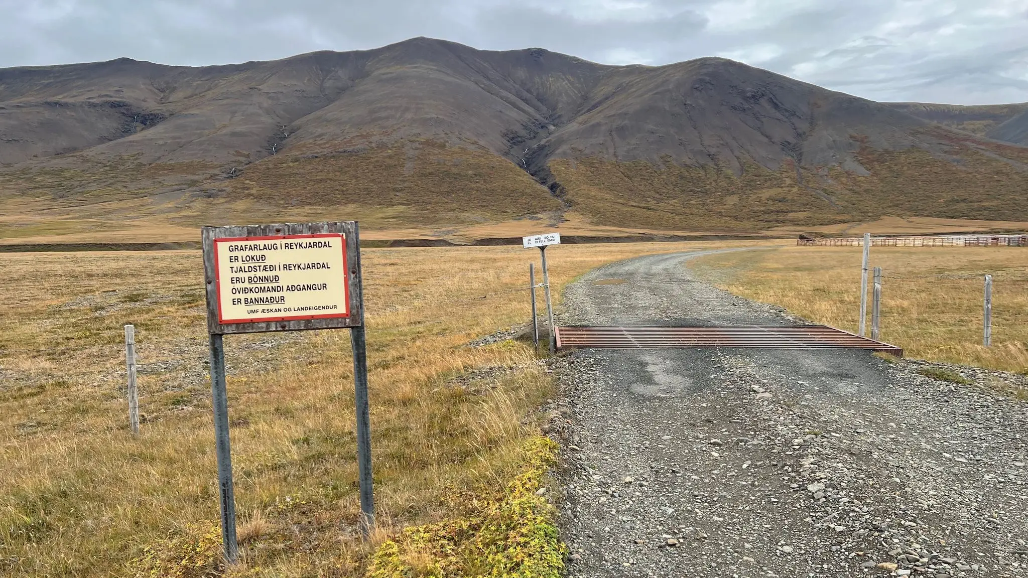
Beside the dirt road at its start, by the sign and the cattle grid.
A sign at the start of the road, from UMF Æskan and the landowners, says that Grafarlaug is closed, that camping in Reykjadalur is prohibited and that unauthorised access is prohibited. The sign looked old and the road was open across a cattle grid. We took it to be aimed mainly at vehicles heading for the pool, and walked the road rather than driving it.
None
181 MORE ROUTES ARE ON THE WAY
Conditions in Iceland change fast - check safetravel.is before you go, and read our terms: you hike at your own risk.