Mountain-bike path on the ascent Variant
Stay on the mountain-bike path to bypass the steep rocky hiking shortcut. We used this path on the descent; several rockfall obstructions remain passable on foot.
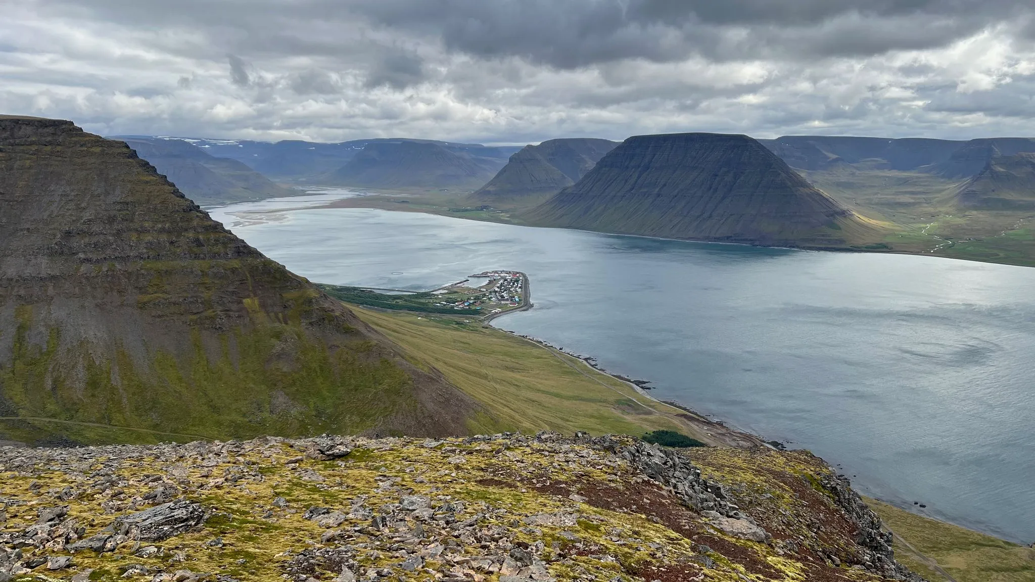
Westfjords · Flateyri, Önundarfjörður · Hiked August 2026
A climb above Flateyri for expansive views of Önundarfjörður
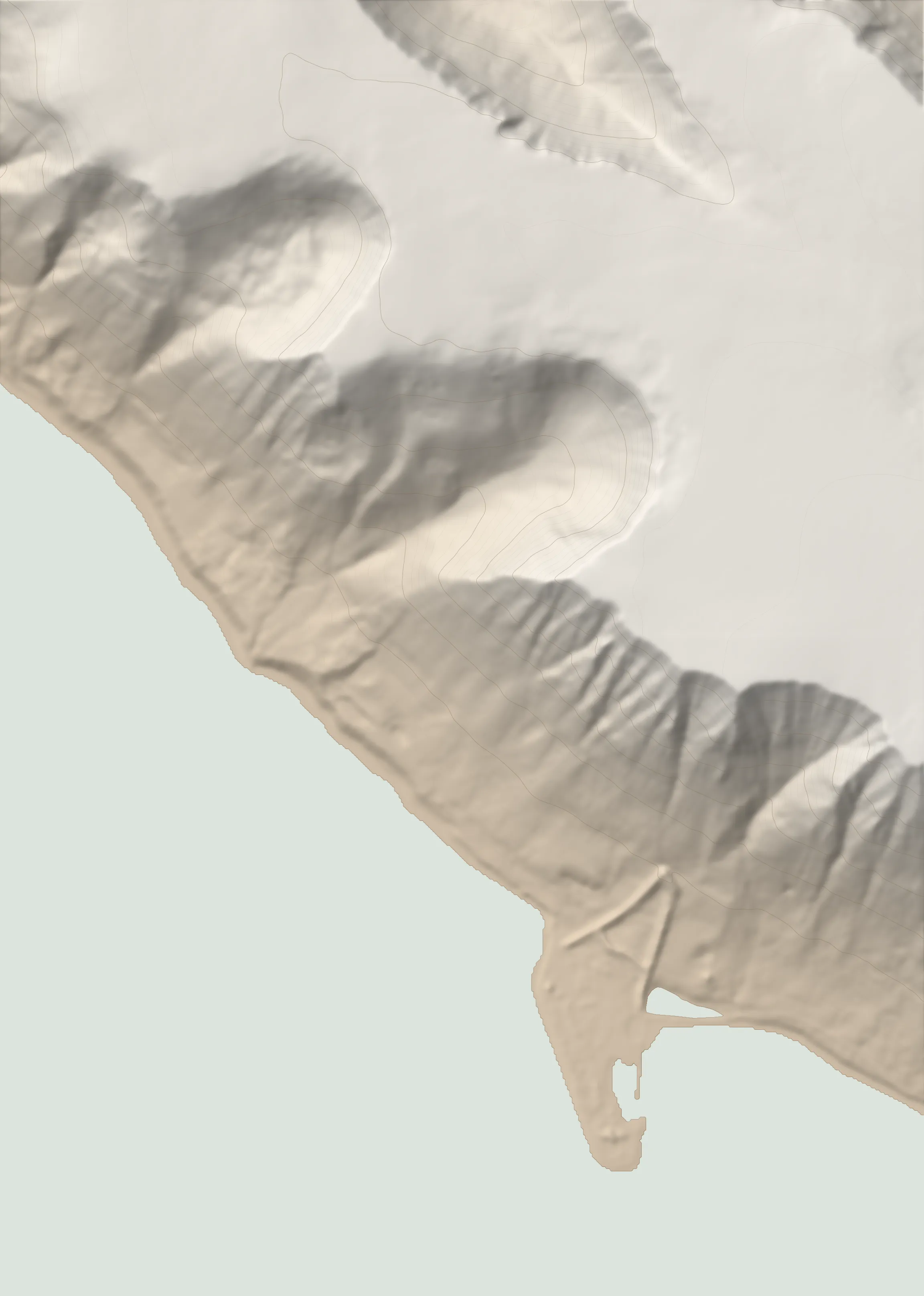 TRAILHEAD SELJANEF 583 M
Seljanef is a viewpoint high above Flateyri, a village built on a flat spit of land in Önundarfjörður, with expansive views over both. From the roadside at the edge of the village, follow a gently ascending farm track and then an engineered mountain-bike path through a boulder field. The ascent takes a steep rocky hiking shortcut before crossing a staked plateau of moss and loose basalt to the viewpoint. Allow about two hours to the top from the valley. Return the same way, optionally using the mountain-bike path to descend around the hiking shortcut.
0.0–2.0 km · climb, heading NNW · 3 → 177 m (9%)
Terrain Grassy at first, then follow the gently ascending farm track.
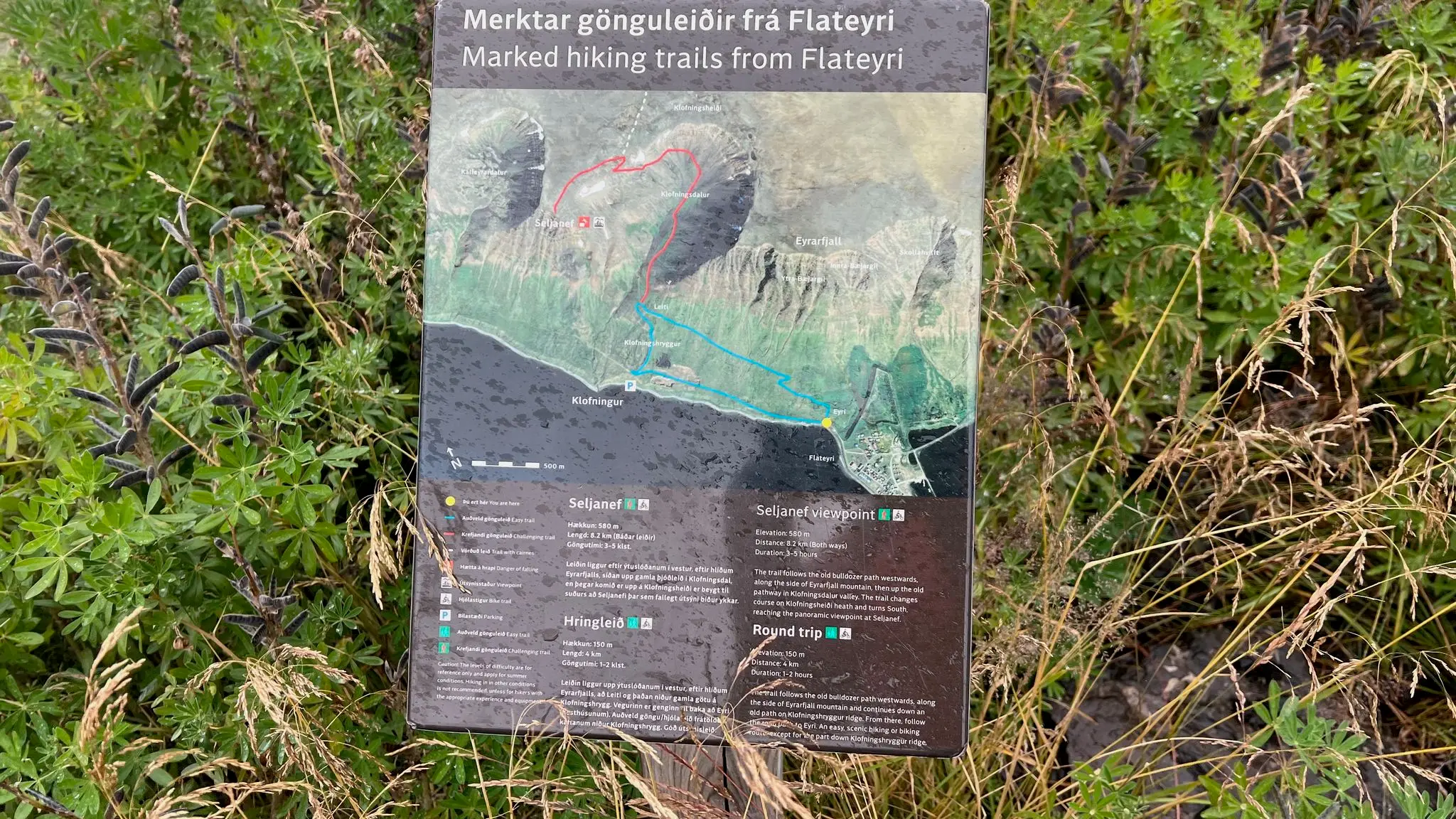
Information panel · 0.2 km · 13 m
Information about this hike and the lower walk. 0.2 km
Intersection · 0.4 km · 51 m
Ignore the spur heading NE. 0.4 km
Gate · 0.5 km · 51 m
Go through the gate and continue on the farm track. 0.5 km
The farm track makes a switchback. 0.7 km
2.0–4.7 km · steep climb, heading N · 177 → 602 m (16%)
Intersection · 2.0 km · 181 m
The lower loop turns downhill here. Stay on the farm track as it angles NE. 2.0 km
Terrain The farm track becomes an engineered mountain-bike path through a boulder field. 2.8 km
Intersection · 2.9 km · 359 m
The hiking trail branches left, northwards, then climbs sharply. Stay on the bike path if this shortcut is too rocky. 2.9 km
Terrain Steep and rocky, with some switchbacks. No scrambling, exposure or consequential drops.
Intersection · 3.3 km · 506 m
Rejoin the mountain-bike path. 3.3 km
Intersection · 3.6 km · 581 m
Leave the mountain-bike path, which continues over the plateau towards the next fjord, and head west towards the viewpoint. 3.6 km
Terrain Moss and loose basalt rocks on the plateau.
View A great viewpoint over Flateyri and Önundarfjörður. 4.3 km
Hazard The viewpoint is beside a steep drop. Do not get too close to the edge.
High point · 4.7 km · 602 m
4.7–6.9 km · steep descent, heading S · 602 → 178 m (-19%)
Return along the outward route.
Stay on the mountain-bike path to descend around the steep hiking shortcut. 5.2 km
Hazard The mountain-bike path appears unmaintained and is blocked by several rockfall sections, though still passable on foot.
Rejoin the outward line. 6.0 km
6.9–9.0 km · descent, heading SSE · 178 → 3 m (-9%)
Terrain Follow the farm track back down to the start.
From Ísafjörður, follow Route 61, then Route 60 through Vestfjarðagöng, continuing straight at the tunnel junction. Turn right onto Route 64 after leaving the tunnel and follow it to Flateyri.
Beside the road just as you leave Flateyri, near the start of the walk. An ordinary car is fine.
None
181 MORE ROUTES ARE ON THE WAY
Conditions in Iceland change fast - check safetravel.is before you go, and read our terms: you hike at your own risk.