NW peak only Shorter
Return from the first peak only for a 5.5km return trip taking 3h, instead of continuing along the ridges to the eastern and southern peaks.
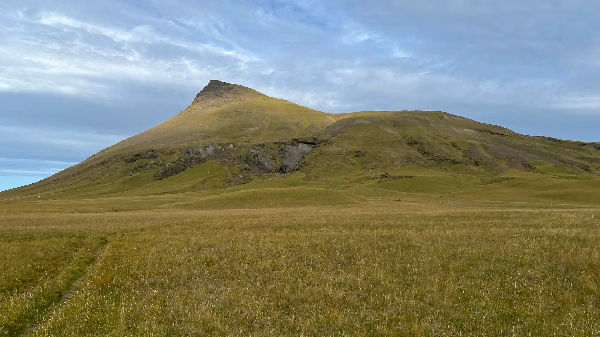
South Iceland · Katla Geopark, near Hvolsvöllur · Hiked August 2024
Pleasant hike with amazing views
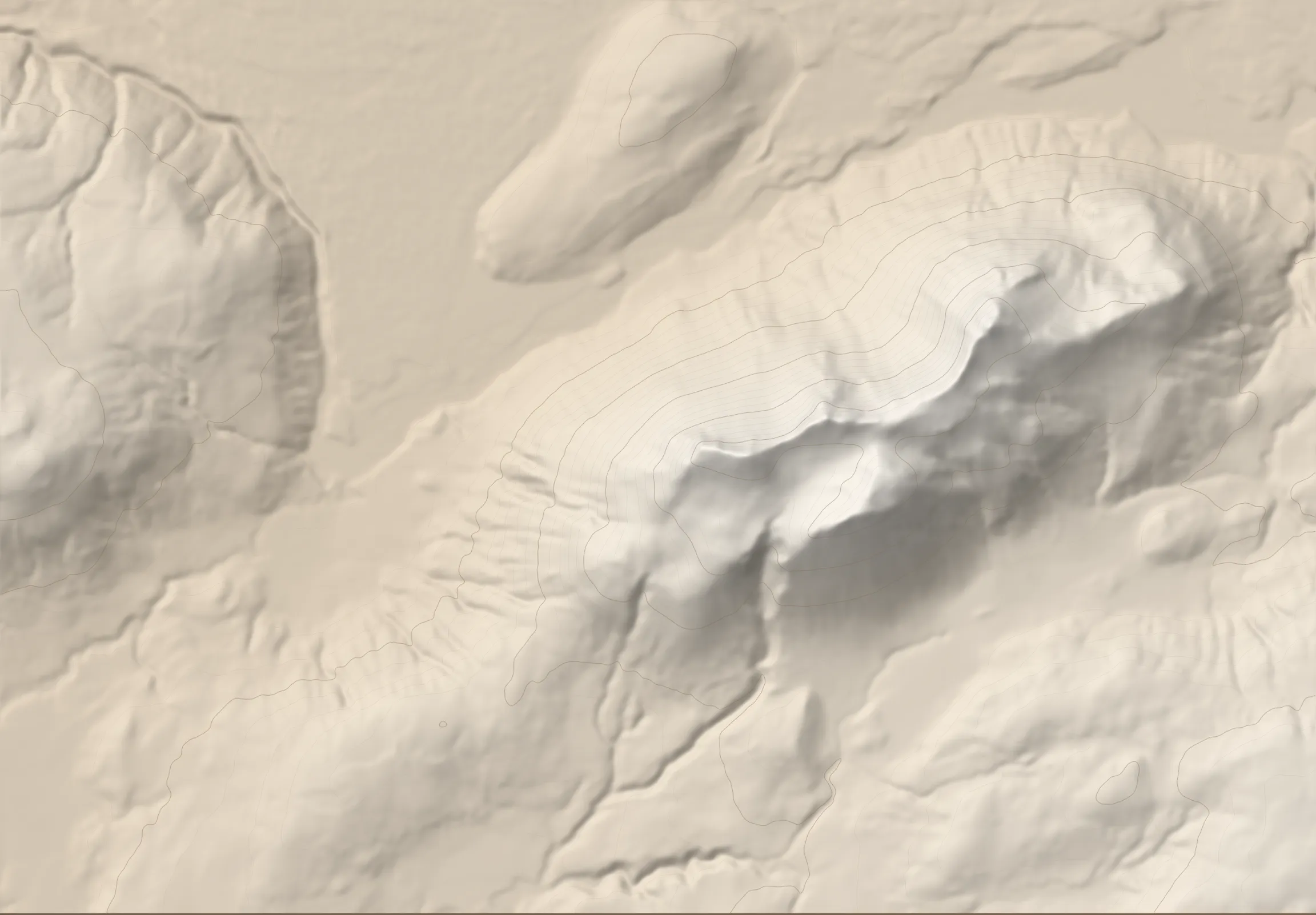 ÞRÍHYRNINGUR 678 M TRAILHEAD
Þríhyrningur is a mountain rising from the vast volcanic plains of southern Iceland. Even though it stands at just 678 meters, its isolated position lets it dominate the surrounding landscape, offering unobstructed, expansive views across this picturesque corner of Iceland. As its name suggests, Þríhyrningur features three prominent peaks that can be strung together in a walk that needs no climbing gear. The trail to the westernmost peak is staked and well defined. To reach the eastern and southern peaks, you follow the ridges around the mountain’s inner valley, named Flosadalur.
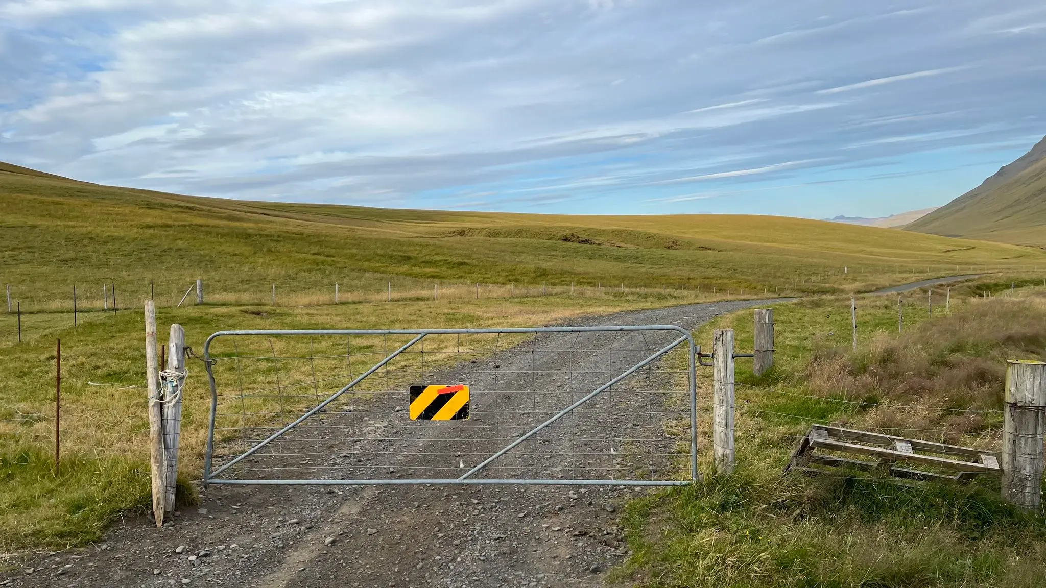
From the parking spot just inside the edge of the Vatnsdalur farm, go north through the gate, closing it behind you.
Cross a shallow stream named Vatnsdalslækur on foot. Depending on the water level you might need to take your boots off. Once across the river turn eastward aiming for a white placard with the hike description which marks the official start of the trek.
After the sign ignore the farm track that heads SE, instead look to your left for trail indicators leading eastward across the meadow. At 0.5km bypass a fence via an a-frame stile.
Continue to follow the obvious path across the grassland, angling SE. Stakes are present albeit rare.
At about 0.75km you will reach the foot of the mountain. The path is well trodden and the trail markers are more densely spaced. Underfoot the grass gives way to dirt, then, on sections, to small, kitty-litter-like scree.
The first break into the ascent occurs at 1.6km (401m asl) on a rocky plateau. Take a moment to look south towards the verdant valley flanked by rolling hills. The gentle relief was shaped by the retreating glaciers of the last ice age.
After a quick respite the ascent resumes. At about 2km from the start the marked trail veers NE then N towards the first peak.
The slope is steep and filled with loose rocks which will slow down your progress. There are no switchbacks. The trail markers are somewhat camouflaged against the rocks and easy to miss.
You will reach the ridge at around 2.5km. Turn eastward and follow the ridge line to the summit.
The highest point of the western summit is marked by a cairn, however there is no visitor log.
The views are expansive in all directions. To the west, a flat-topped hill named Vatnsdalsfjall (341m) features a small glacial lake at the top (Vatnsdalsvatn).
To the north, a vast glacial field is crisscrossed by sinuous rivers. The closest one is Fiská; in the distance you might be able to get a glimpse of Eystri-Rangá. On a clear day the massive Langjökull glacier is visible as a white ribbon near the horizon.
The famed Hekla volcano (about 1490m) rises prominently NNE. Hekla is one of the most active and explosive Icelandic volcanos.
To the NE the view is dominated by Þríhyrningur’s inner valley, named Flosadalur after the character Flosi from Njáls saga. The valley separates the western and eastern peaks of the massif.
To the south, beyond the glacial plains of south Iceland, the Vestmannaeyjar archipelago emerges as a series of overlapping blobs. Visible at a certain distance to the right of the main archipelago, the Surtsey island is one of the newest bits of land in Iceland, having been formed by a volcanic eruption started in 1963. It is also the southernmost point of Iceland.
If time and conditions allow, continue your hike eastward along the ridge. A faint path exists but it is not marked by stakes.
The ridge is dotted with numerous rocky peaks, inviting exploration.
The path keeps predominantly to the ridge, making for an exhilarating walk.
At about 3.4km a rocky outcrop can be bypassed left or tackled straight on. The left (northern) bypass is thrilling but exposed.
The ridge continues past the end of Flosadalur and the trail switches to the eastern versant, just below the ridge. In contrast with the lush greenery on the western slope, this side is rocky and devoid of vegetation. Wind and ice carved interesting tuff formations along the ridge line.
At the 4km mark the trail descends and intersects with a lower path, en route towards the eastern peak of the massif.
The ascent to the eastern summit is short but steep and somewhat technical. You will have to deal with loose scree and unstable rocks. At the top another excellent vantage point emerges, with unimpeded views on three sides.
On the east side the dominant feature is the Eyjafjallajökull glacier on top of the Eyjafjöll stratovolcano. Eyjafjöll last erupted in 2010, disrupting the air traffic across the Atlantic and Western Europe, and in the process, jump-starting the tourist industry in Iceland.
To Eyjafjallajökull’s left and farther away you can see the larger Mýrdalsjökull glacier capping the Katla volcano, infamous for its explosive basalt eruptions and jökulhlaups (glacial floods).
Further north the jagged peaks of Tindfjöll shelter another ice cap, Tindfjallajökull.
To continue, retrace your steps down the steep, talus-filled slope of the eastern peak.
At the trail intersection at 4.6km take the lower path then continue across the grade for the next 0.5km. At the 5.1km mark, as you are about to enter Flosadalur, the path becomes indistinguishable. Veer S, descending into the back of the valley, then climb up steeply towards the southern peak.
After the initial steep incline, the path leads along a rounded, vegetated ridge.
Reach the top of the south ridge at around 5.6km. Along the way you’ll have a different perspective of the northern ridge and the prominent northern peak across Flosadalur.
Continue SW along the ridge shortly before a sharp drop forces a turn to the north in order to descend into the valley.
Once at the bottom of the valley the path disappears once again. Head W, crossing the dry, rocky stream bed at around the 6km mark. Continue ESE until rejoining the marked path at around 6.7km, then follow it back down to the parking spot.
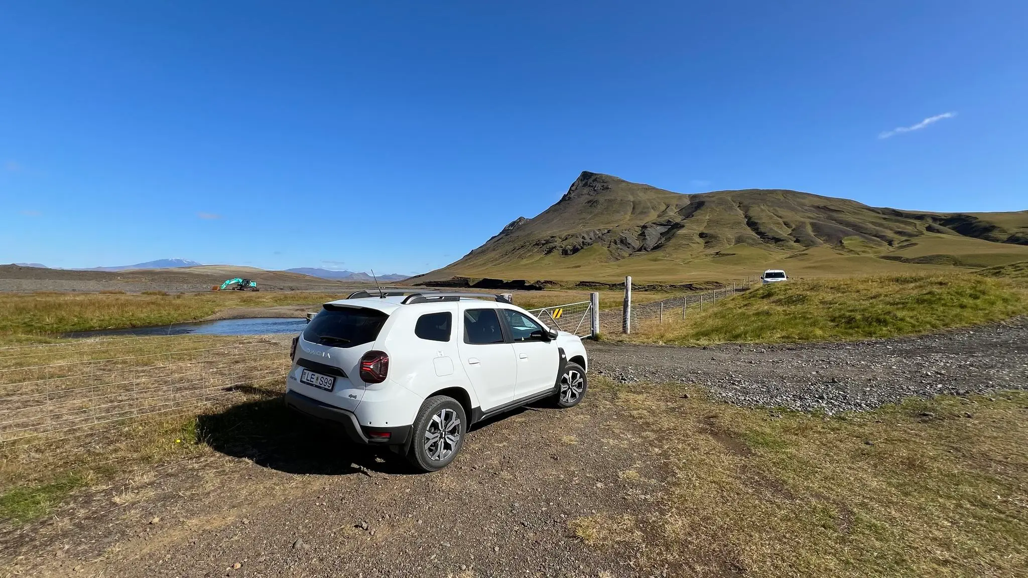
From Reykjavík take the Ring Road towards Hvolsvöllur. In Hvolsvöllur, turn left on Fljótshlíðarvegur (rt 261 towards Fljótshlíð) and continue for 8.3km. Turn left on a minor road towards Tumastaðir / Tunga / Vatnsdalur. You will be on this road for about 7km. The road first passes through the Tumastaðir forest. Past the forestry building the road turns to gravel. After about 4km from the 261 intersection you will encounter a closed farm gate. Open and then close the gate behind you, then continue north. Past the Vatnsdalur farm buildings the road veers eastward. Keep on it until you encounter another farm gate on the northern edge of the farm property. If you have a high-clearance vehicle you can continue through the gate and then through a shallow stream to the official parking area for the hike about 200m to the east. Otherwise park near the gate.
Starting coordinates: 63.78257° N, 20.02437° W (parking near the farm gate) or 63.78232° N, 20.02173° W (parking area near the informational panel).
Sturdy boots (backpacking or light mountaineering) are recommended. Hiking poles recommended for balance. Insect net recommended in summer at lower altitudes.
181 MORE ROUTES ARE ON THE WAY
Conditions in Iceland change fast - check safetravel.is before you go, and read our terms: you hike at your own risk.